
What we saw:
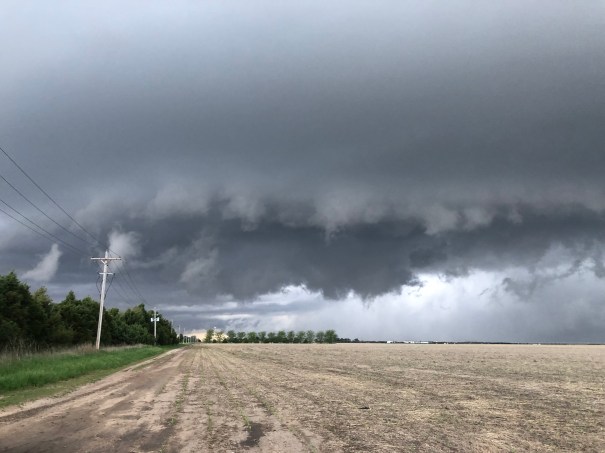
The initial supercell near Brush, Colorado had a wall cloud, a velocity couplet on radar, and then a very brief spin up of a ground circulation underneath a small funnel cloud. At this time, the storm was not pushing outflow, so this was not a gustnado.
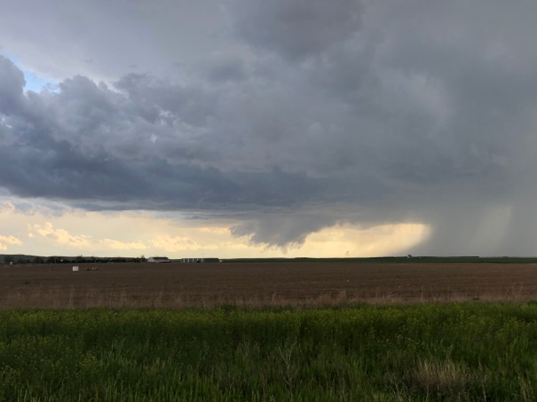
This storm became outflow dominant, with a massive hail core. We drove through part of that and measured temperatures that had dropped from 73F to 42F. So we dropped south to a developing storm near Holyoke, CO. It quickly developed a wall cloud and what appeared from our distance to be a tornado.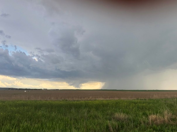
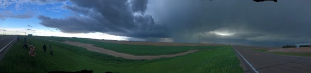
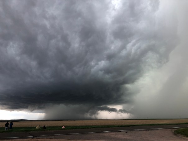
This storm had wild features, and at one time developed an awesome hail core that descended to the ground. By the way you can see the helical updraft that developed to the right of the view. You’re looking edge on at the vortex tube. And there may have been a brief additional tornado.
 The storm became a stacked wedding cake, with beautiful lightning on its northeast flank.
Later on as it came into Imperial, marble to golf ball hail treated our dinner gathering
____________________________________________________________________
Targeting Decision
A weak cyclonic circulation in Nebraska had circulated dew points > 50F into northeastern Colorado. Surmounting this was a strong southwesterly jet.

CAPE values of around 1500 J/kg and 0-6 km vertical shear values of around 40 knots created an environment for long-lived storms, particularly in northeastern Colorado where CIN values would be low or zero by mid afternoon. Low level shear values were just into the range in which mesocyclone tornadoes would be possible. The Hodographs had nice anticyclonic sickle shapes.
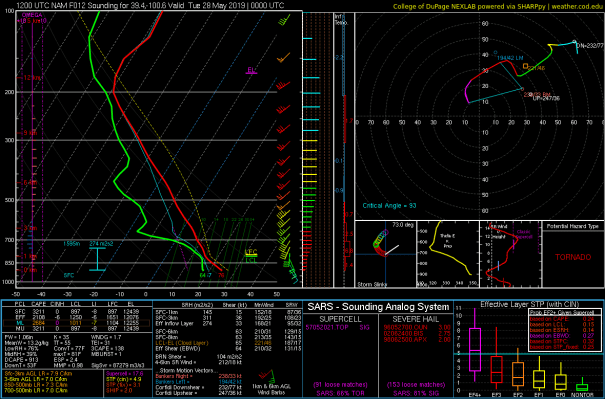
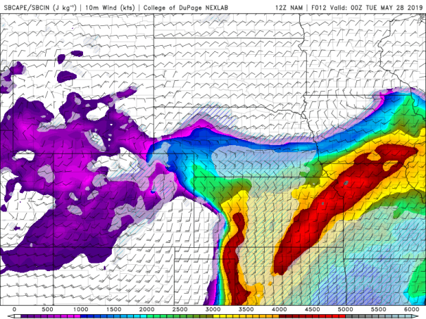
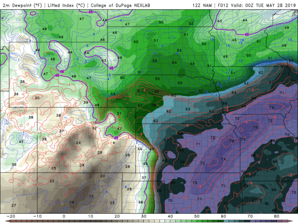
So we targeted the area near Limon, Colorado.
