What We Saw

Here are the seasoned meteorologists who were collaborating on this chase. Left to Right, Scott Landolt, John Monteverdi, Sam Ng, Cameron Redwine.
This is a panorama movie showing the first cell we chased. It had promise. Here you see the Rear Flank Downdraft cut, the updraft area with a ragged wall cloud, the forward flank rain area, and the outstretched anvil.
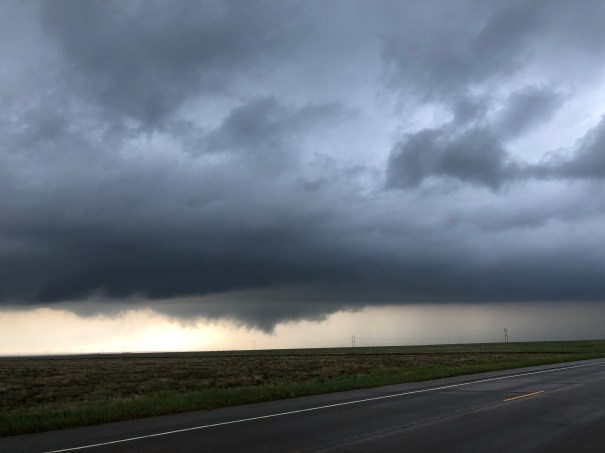 The initial storm we tracked in se Colorado looked briefly good. But we left that behind to target a storm southwest of Lamar, Colorado. It had intermittent wall clouds and reports of tornadoes. We did not see any tornadoes…but in these two pictures apparently observers near by the features saw them. The storm was tornado warned.
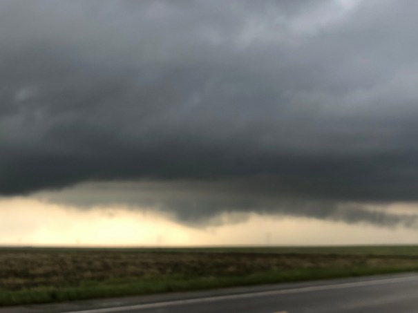
We tracked the storm northward, but eventually decided it was becoming outflow dominant, which means it was no longer drawing in warm unstable air. Along the way, we were subjected to a convergence of idiotic chasers, including this joker.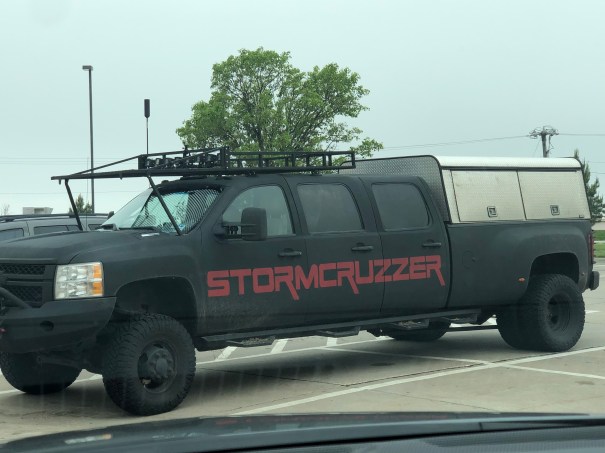
 The radar imagery shows the development of the hook on the storm near Lamar. The radar site was Pueblo, CO, which was to the left of the image. You will note the couplet that developed on the south side of the storm (green next to red on the velocity image) and the associated tornado warming (red quadrilateral).
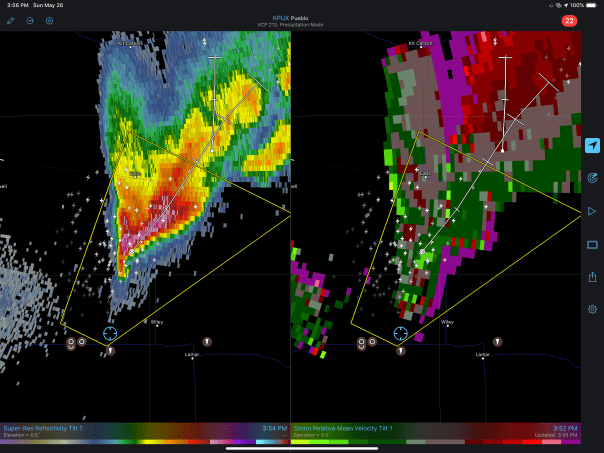

________________________________________
Targeting Decision
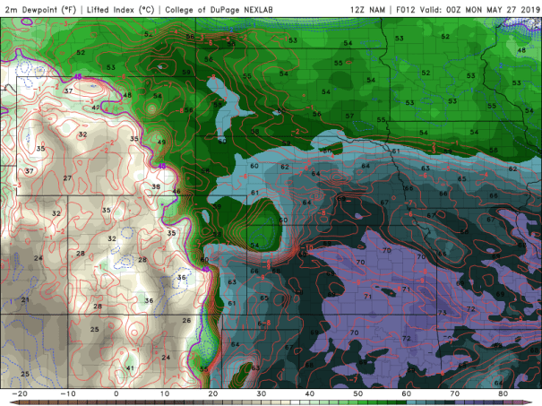
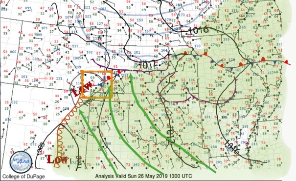
Today’s surface weather map has a mesolow developing in southeastern Colorado. A synoptic scale stationary front extends northeast of that intersecting an outflow boundary with ongoing elevated convection northeast of that.
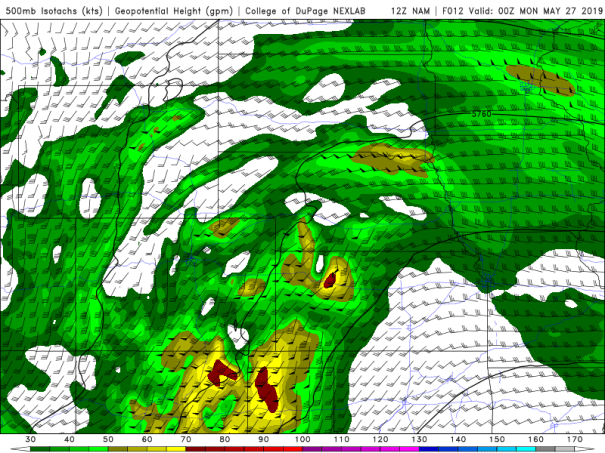
At 500 mb, a short wave trough with upwards vertical velocity associated with it is moving through New Mexico. 40-50 knot southwesterly winds are associated with it.
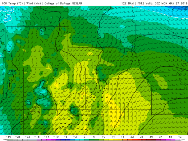
At 700 mb, 10-12C temperatures are found over western KS into the western Panhandles indicating a breakable capping inversion during the day.
Forecast soundings in the area of upslope flow in eastern Colorado and at the eastern edge of the outflow boundary in northwest KS are favorable for supercells. The eastern area is more problematic because of the rapid evolution of the outflow boundary.
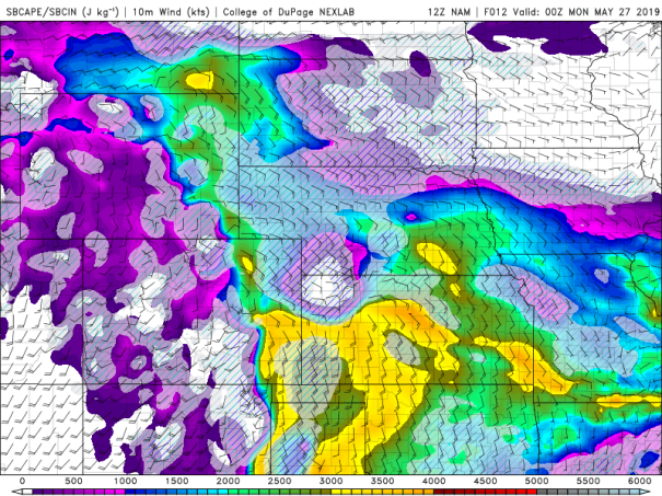
CAPE, little to no CIN, deep layer shear favoring both longetivity and mid level mesocyclones, low level shear favoring the development of low level rotation…all are focused in these two areas.
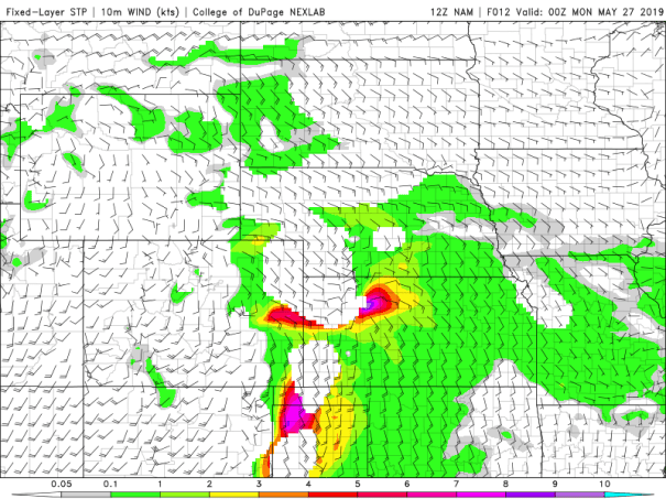
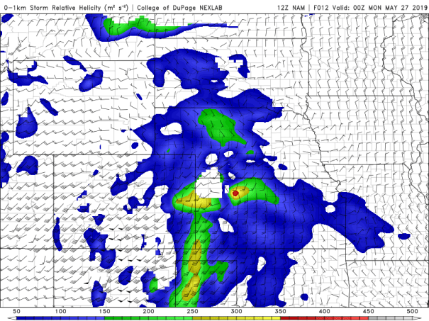
Hence our target is as shown in the box on the surface chart above. I’ve put some other charts below that I will refer to when I have more time.