
What we saw
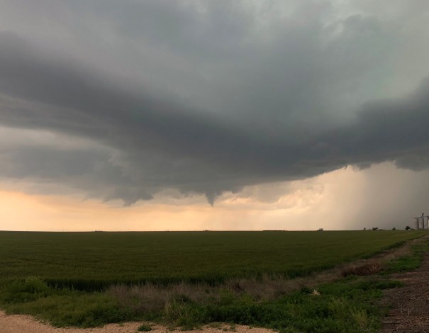
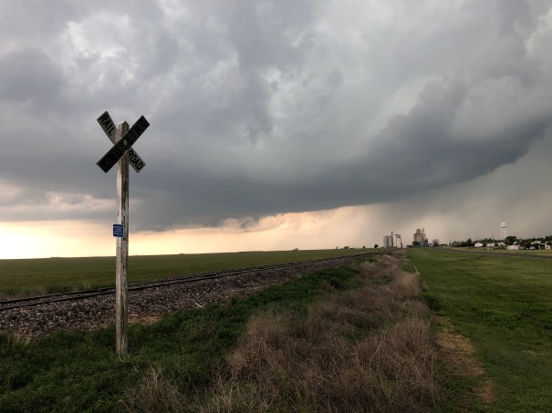
in extreme sw Kansas. As we were driving to the apex of our target area a storm formed there and became a weak supercell.
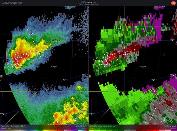
We drove east and then south to get ahead of the storm and got to the rain-free base. It had several lowering, and also a brief funnel cloud. We also noticed “inflow stingers” coming into the storm at mid levels. But it’s life was brief. Storms to the south rapidly moved northward into the updraft area of the storm and suppressed it. Still, at least we had a chase this first day.
________________________________________________________________________________
Targeting Decision
I am currently in Denver awaiting the other members of the group I will be with, including Drs. Sam Ng, Scott Landolt and veteran chaser Cameron Redwine. They will be leading a crew of student meteorologists from Metropolitan State University in Denver.
The morning surface chart shows a stationary front extending from southwest to northeast from extreme northeast New Mexico to Iowa.
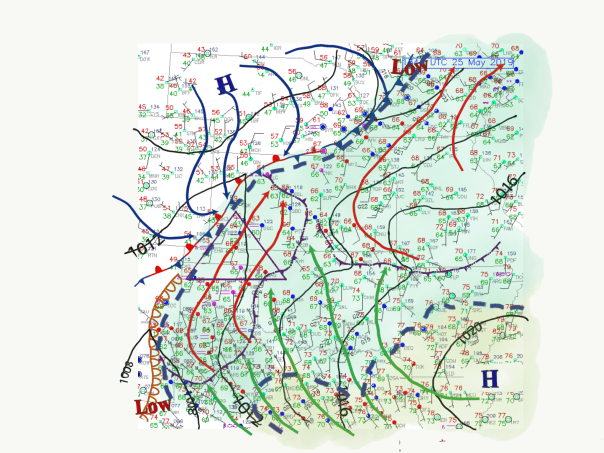
South of that boundary high dew points are found through the whole region. There area couple of outflow boundaries that are left behind from last night’s convection. One large old cold pool extends from southwest KS to theTX Panhandle. That is expected to moderate during the day.
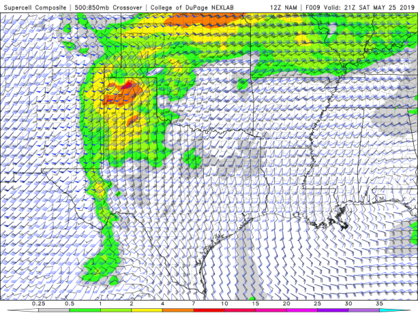
Aloft, strong southwesterly winds at 500 mb are expected to overspread the area roughly shown in the triangle above by the afternoon, with wind speeds 40 knots and greater. At 700 mb, the edge of the warm air cap seems to be on the southeastern edge of that triangle. So the Lid Strength index shows a breakable cap over the western OK and TX Panhandles and sw KS.

Underneath the cap southeasterly winds are bringing an air mass with high CAPE lapping at the edges of the cap. 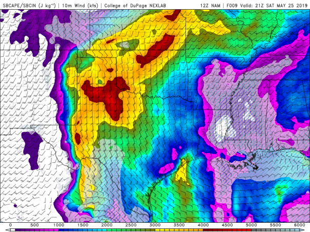
The indices that combine the factors leading to Tornadic supercells are there fore focused in this area.
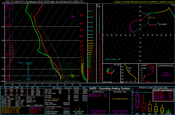
Forecast soundings plotted through the area are quite interesting. The one above is for a location just northeast of Perryton TX.
So my early thoughts are that the region roughly in the triangle on the surface analysis above would be a target. There is another target in eastern KS that bears analysis…and I’ll look at that too later.
