Summary
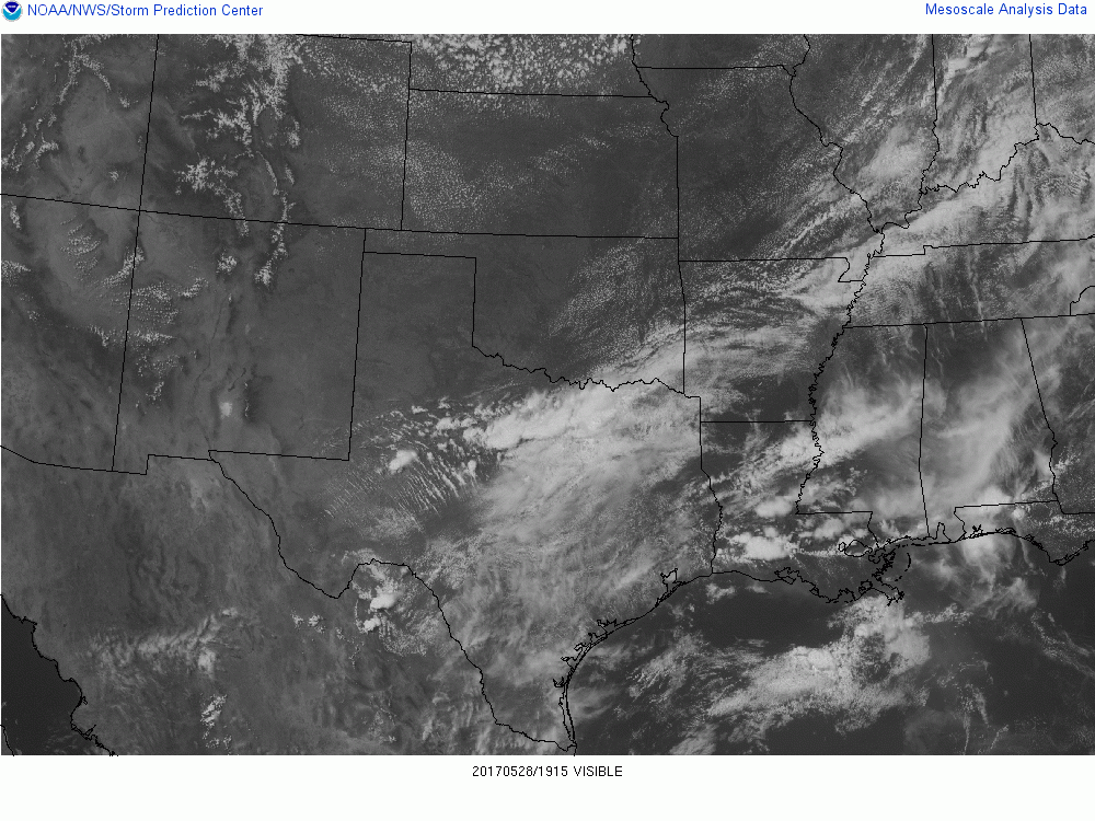
We crossed into Texas just north of the cold front that was slowly sliding southward.


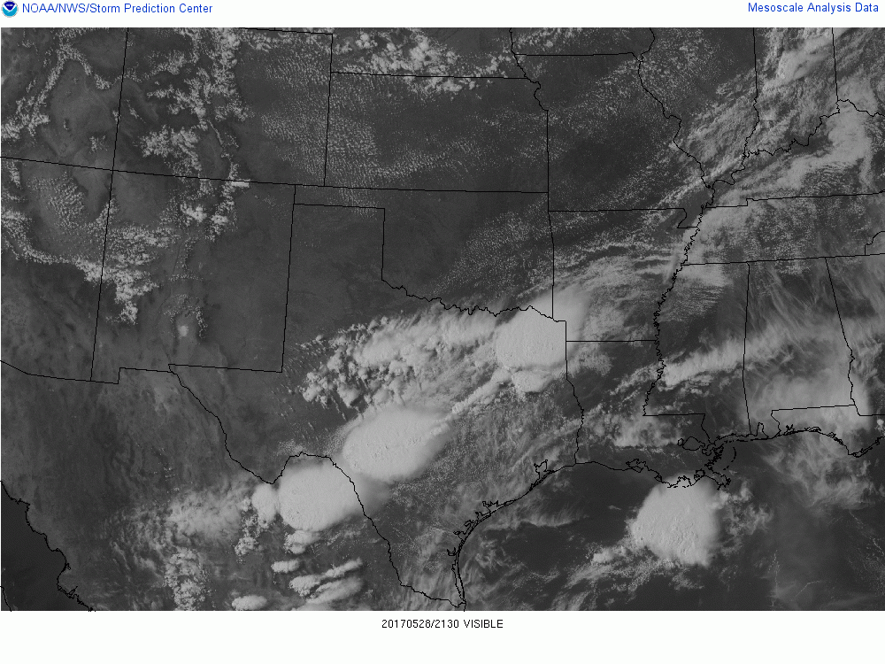
As we had lunch, thunderstorms erupted along and just north of the boundary. We were targeting the area south of the boundary where thunderstorms would be rooted in the boundary layer. And in that region deep layer vertical shear was favorable for supercells. Storms north of the boundary were strong but disorganized. We drove through several intense cores with staccato cloud to ground lightning.
South of the cold front and west of the outflow boundary coming out of Louisiana, there were isolated cells that had organization and seemed to have brief supercell structures. In fact, one developed into an HP supercell about 20 miles southeast of us, but we did not want to drive through the core to get to it, nor did we like the storm motion, which was fast and moving towards Louisiana. The storm eventually had a Tornado Warning on it.


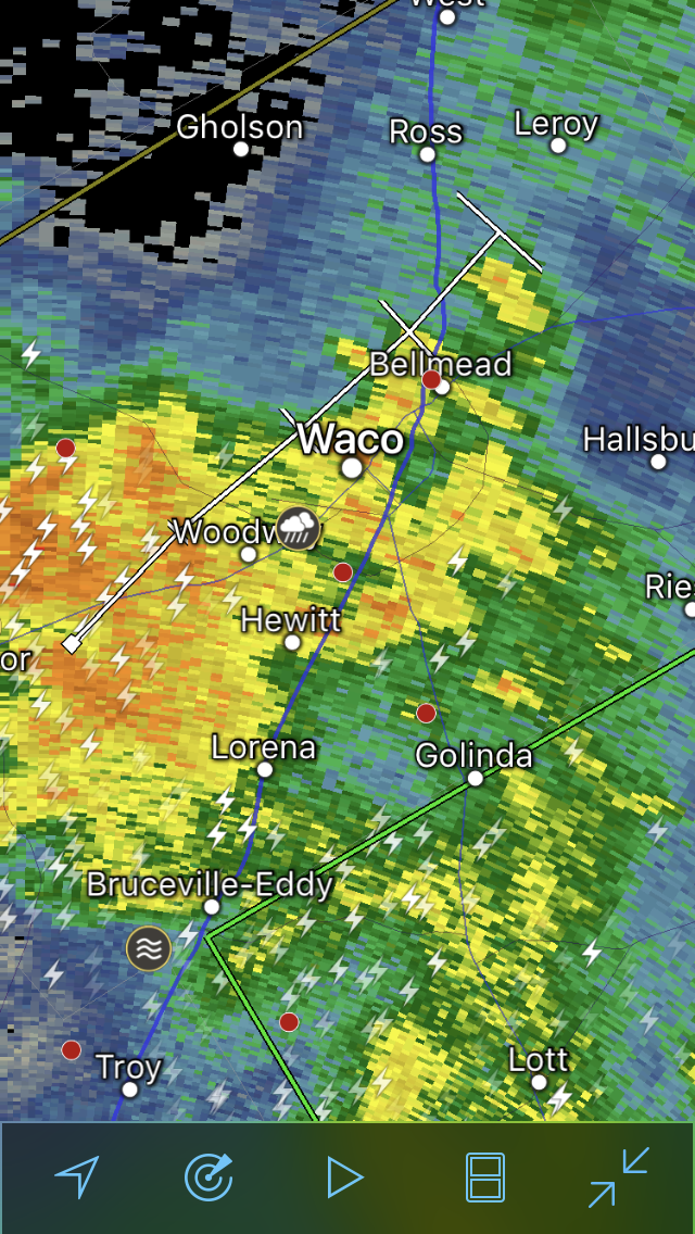
We spent the overnight in Waco as other thunderstorms rolled through that city.
Discussion
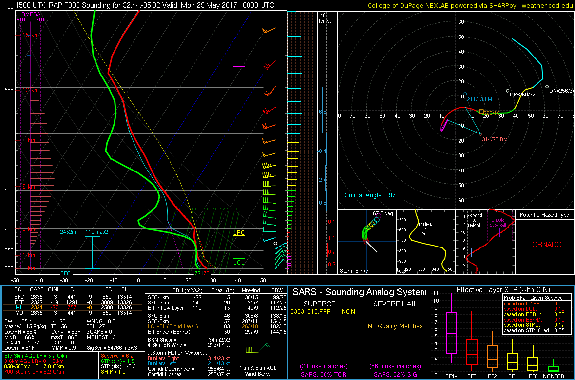
Well we are out here, so might as well pull out all the stops. Our prior target of west central TX disappeared with the reality of the actual observations this morning. so we will drift to ne TX. CAPE and shear there. Outside risk of a supercell there. The outflow boundary there can help with iniation, but there is considerable CIN to its east. The forecast sounding and hodograph is for a location about 50 miles se of Dallas.