
Results
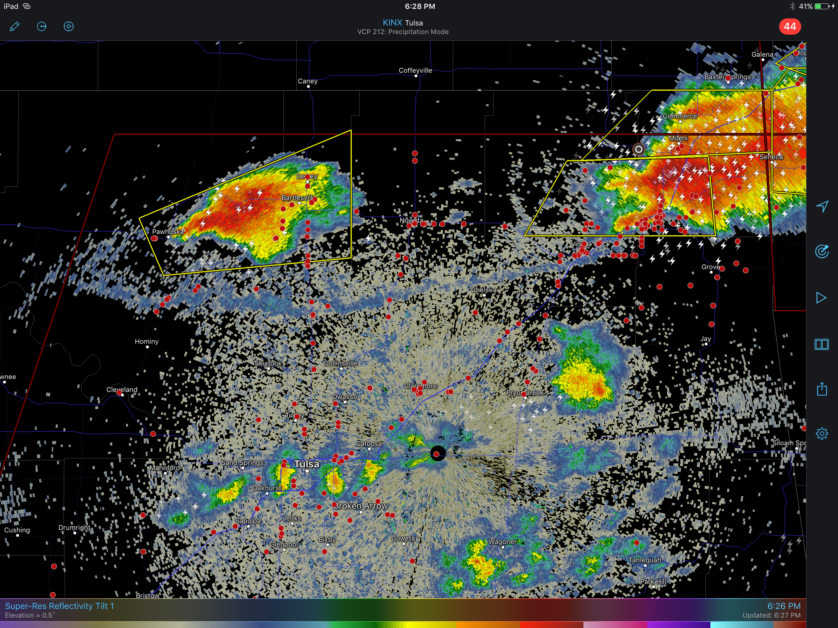
Storms formed along the old outflow boundary in northern Oklahoma around 3PM CDT. We were just west of Tulsa when one developed just west of us. It had some structure, with a couple of bands being entrained into the updraft, and produced some wonderful cloud to ground lightning.

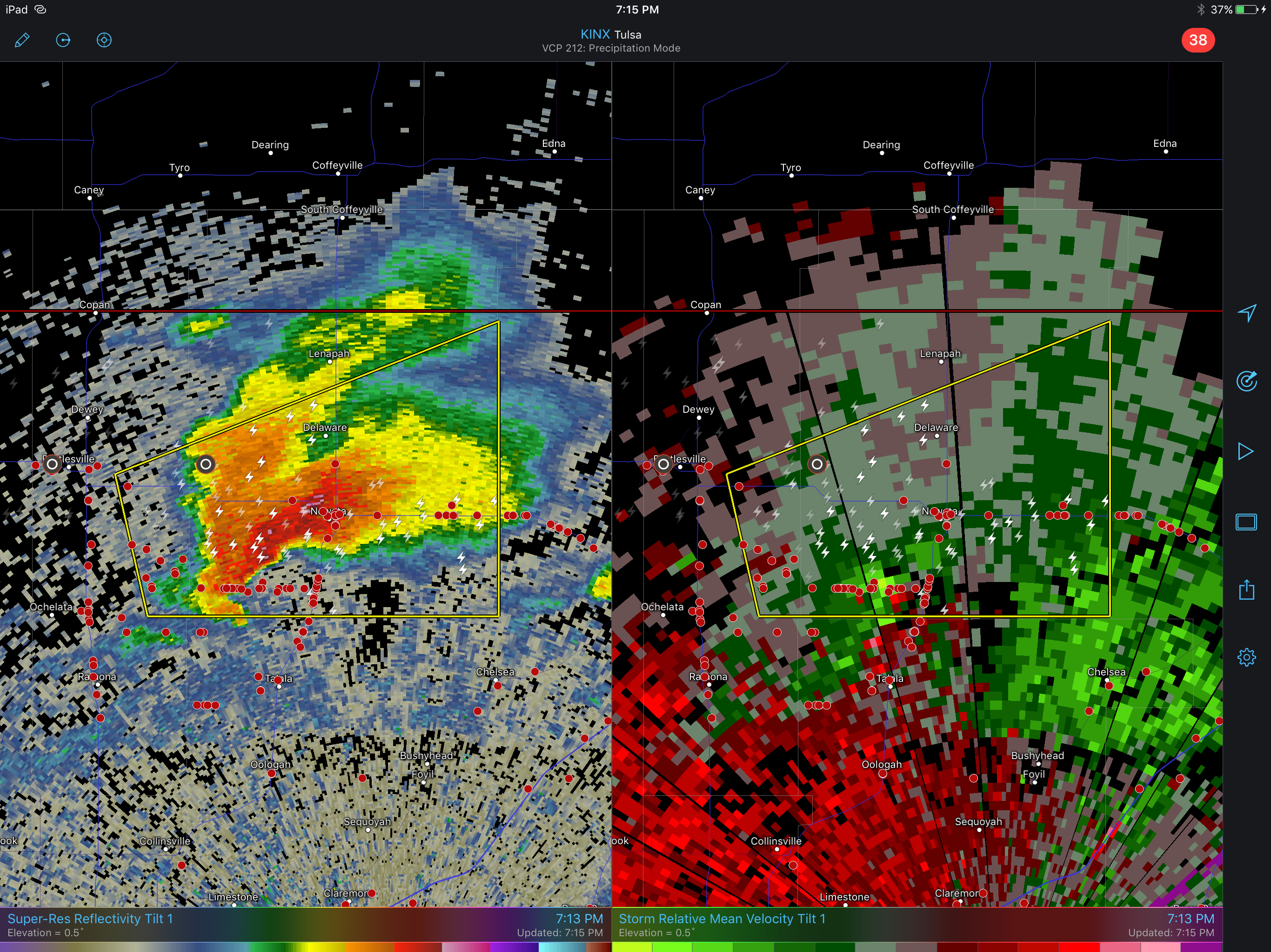
About an hour later a stout updraft developed east of Ponca City. It moved away from the boundary and then appeared to “ingest it” pulling it northward. The storm had a good look with a hook echo and a weak couplet.
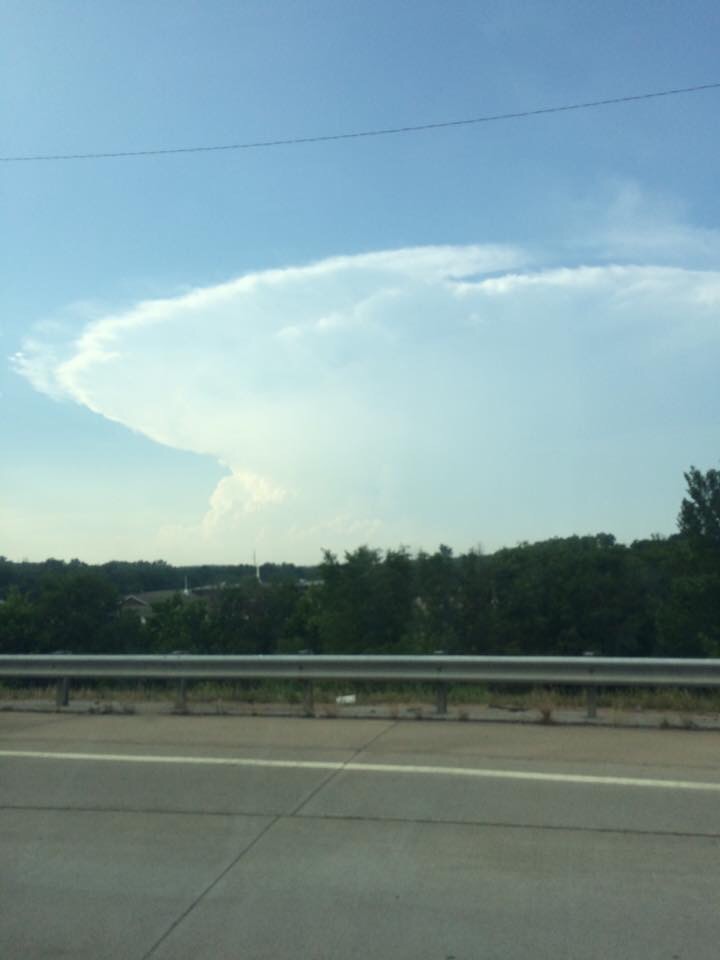
The picture of the anvil is courtesy Vickie Doswell. The storm began to draw chasers away from the storm that was further east in the northern part of the Tornado Watch area (red box).
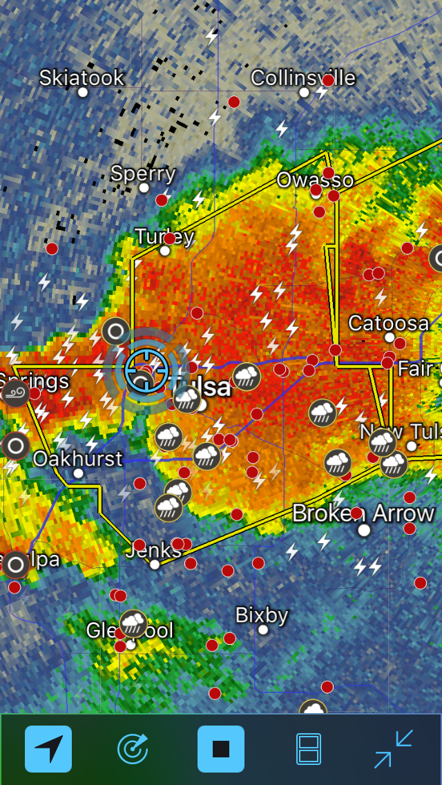
We followed this storm for about an hour until it became clearlyoutflow dominant. As we drifted towards our overnight in Tulsa, a new storm formed and produced a tornado well southwest of us. It was not possible for us to intercept that storm by sunset. As we got to Tulsa, yet another storm developed southwest of Tulsa and moved over the city. As we were eating dinner the weak mesocyclone associated with that storm passed directly over us, putting our location in the “notch”. The storm was weakening and shortly was not a supercell.
Target
We have decided on northern target. Clumping cumulus west of Oklahoma City suggests initiation is about to occur. SOuthwesterly winds aloft will be associated with initial northeast motion into that target.
Discussion
We are currently in Norman Oklahoma in a wait and see mode. The buoyancy in this area is extreme, with 6000 J/kg forecast for the whole central and eastern part of the state this afternoon. The morning map shows an outflow boundary on the northern border and a dryline advancing in the TX Panhandle. There are no obvious convection initiating mechanisms. Models suggest storms in northeast OK and south of us between the Red River and Oklahoma City. Those are our two targets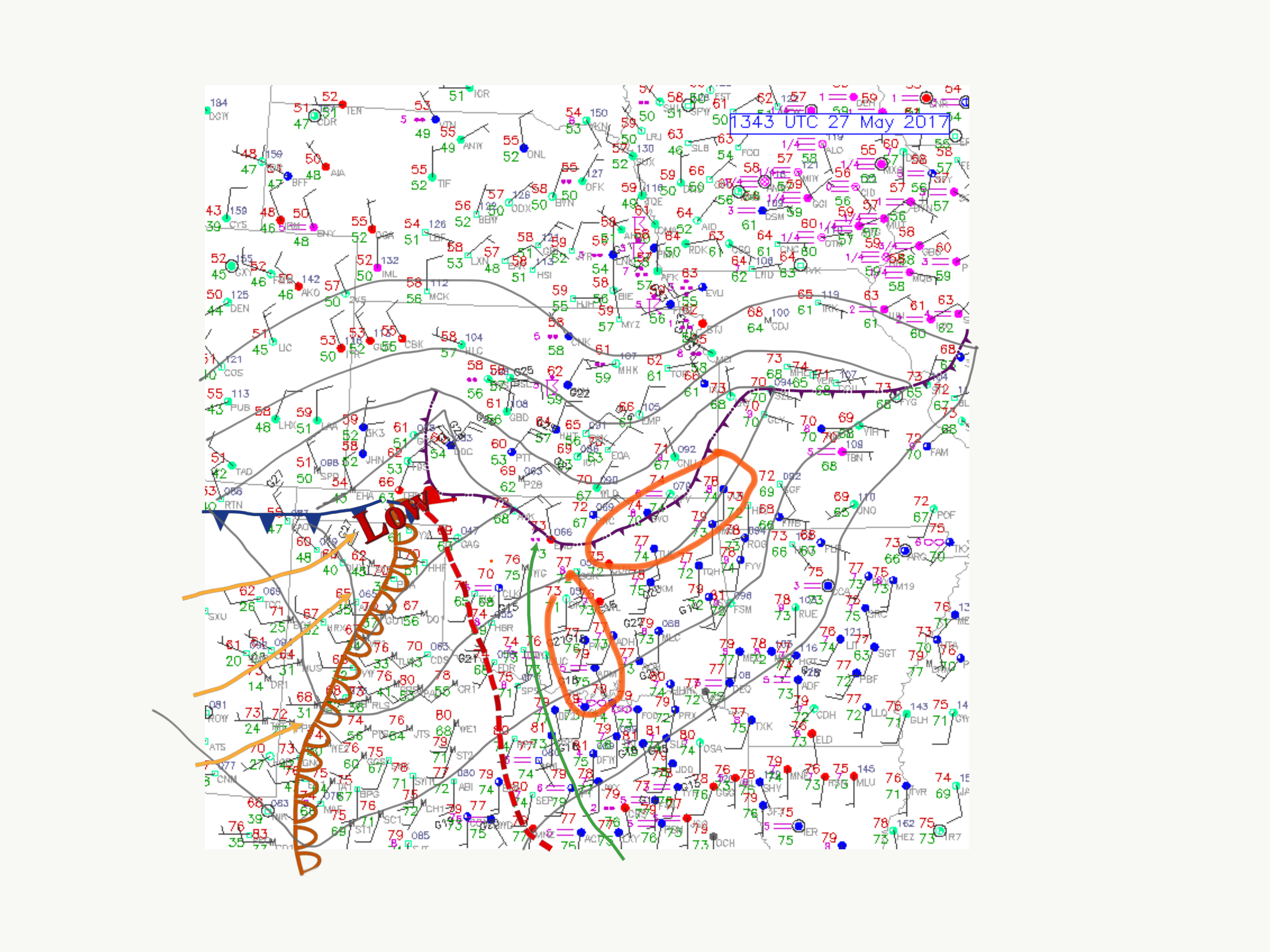 oi
oi
