
Discussion
The period of interest that has been highlighted by the CFSv2 in a number of ways, including the so-called “chiclets” chart is now within range of the medium range models. Within 10 days the accuracy correlations of the prediction of the GFS with verification at least exceeds 0.6 and of the GEFS ensemble mean 0.7.

The lack of general severe weather ingredients over the next few days is highlighted by the blue colors here. But that does not mean that conditions would not be favorable in geographically small areas. In this case, it does appear that severe weather is likely in the extreme southern Great Plains over the next few days. The “X” appearing in the box indicates a Supercell Composite Parameter at least one point exceeding 10.
But it’s clear that the larger, broader pattern favoring risk over a good portion of the Great Plains develops later in the week. For example, take the GEFS spaghetti plot for Saturday May 27 (CDT)…that now shows the development of the subtropical branch mentioned in previous posts below. There is good coherence between the solutions.=
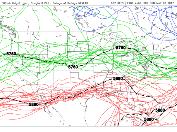
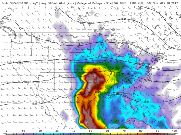
This ushers in (at least in these forecasts) an extended episode of southwesterly winds at 500 mb over the Great Plains. The ensemble mean averages out to around 30 knots, which suggests a deep layer shear (when combined with southeasterly surface flow) favorable for supercells. For example, here is a GEFS plot of the maximum Supercell Composite Parameter for Sunday May 28th.

This is consistent with the ensemble mean’s forecast for surface based CAPE >1000 J/kg and 500 mb winds, which is shown below.
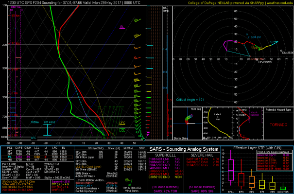
Finally, the operational GFS, which is really one of the 21 solutions averaged out in the two plots above, has some interesting patterns. Here’s the sounding and hodograph for the area along the Oklahoma/KS border south of Pratt, KS, for Sunday 28 May (CDT).
So our plane reservations for May 26 afternoon are holding firm….
