Storm Reports
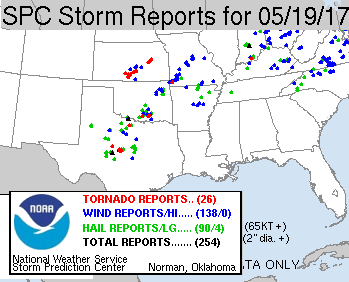
Here are the severe storm reports for this day. There were two tornadoes and a bunch of other reports in our target box. We would have been in the Ardmore area, but whether we would have seen the tornado that was seen there is another question. That storm was an HP-supercell, so being in the right place without putting oneself in danger is difficult. We definitely would have missed the cluster of tornadoes in south-central KS, which really stands out on this map.
Tornado Warnings
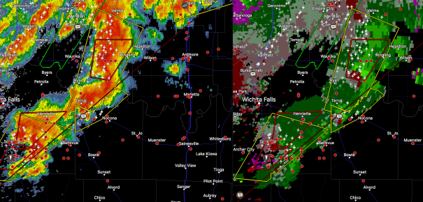
These storms appear to have an inflow coming from the warm air side of the outflow boundary.
Still Virtually Waiting
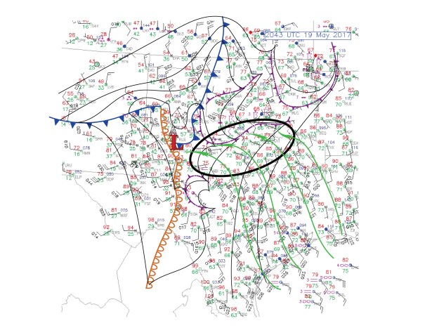
Very moisture rich air converging along outflow boundary complex from nw TX to south-central OK. Still hoping for surface-based convection initiation or motion in that oval. Right now, all cells are moving due north into CIN away from the best water vapor and shear.
Discussion
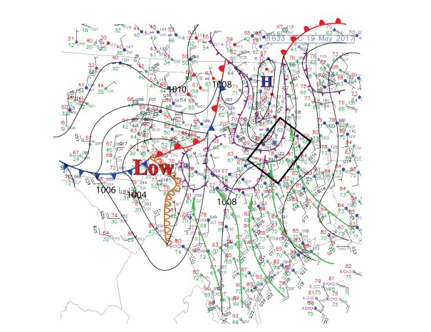
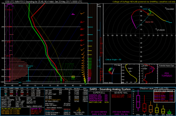
Ingredients setting up with a Red River focus in south-central OK and north-central TX today I think. There are many boundaries to consider. Right now two of them seem to be coming to a halt from sw to ne across that area. The sounding and hodograph is forecast for this evening just northeast of Ardmore OK.