GOES-16 Visible Imagery Loop
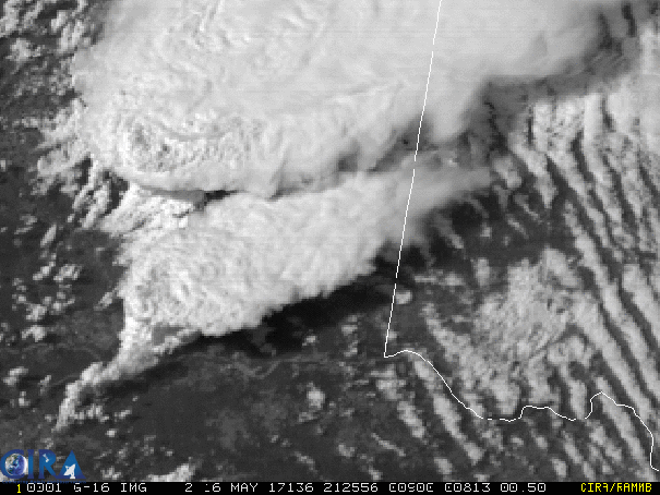
Spectacular high resolution visible imagery from GOES-16 showing McClean TX and Elk City OK tornadic storms. Note the horizontal convective rolls clearly exhibiting helicity being intercepted and deformed into the Elk City supercell’s (southern storm) updraft area.
Elk City Oklahoma Damaged by Tornado
This animation shows the supercell associated with the tornado that caused damage in Elk City, OK, at around 7PM CDT, 16 May 2017.
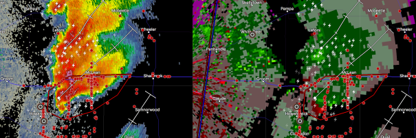
Latest radar image from KAMA, at around 4:30PM CDT.
Discussion
The morning surface map shows a rather uniform setup east of the dryline in the western portion of the southern Great Plains. Rich moisture is being advected rapidly into the area from south-central KS south to north Texas into a deep wave cyclone.
A focus has been forecast to develop in the eastern TX Panhandle into w Oklahoma today in association with the development of mesoscale low pressure in northeastern New Mexico and the northern TX Panhandle. This is already affecting the wind field in ne New Mexico.
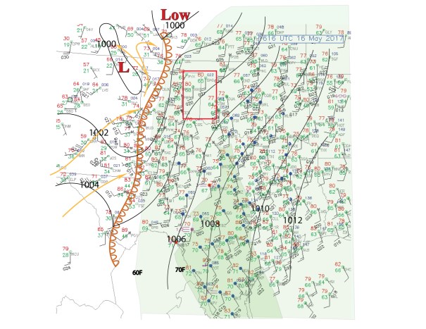
Southwesterly winds of 40 to 50 knots already overlies this area at 500 mb. This is expected to continue during the day as the dry line processes eastward, and convergence between it and the moisture tongue focuses in the area highlighted. Earlier runs had a dryline bulge into that area as well, though the latest NAM forecast for 21 UTC does not.
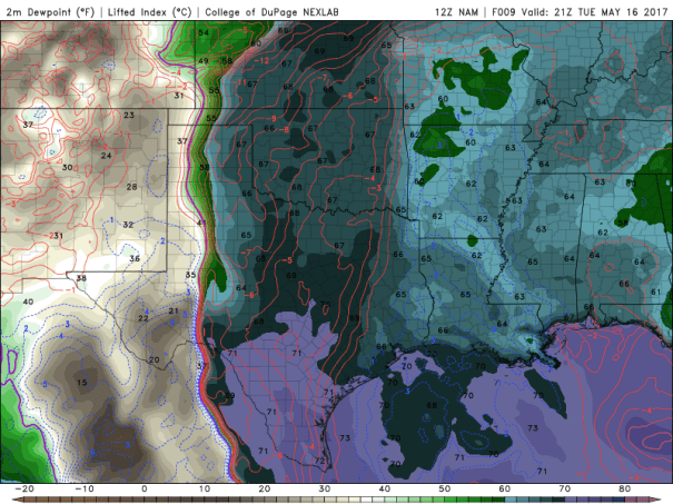
It does not appear that initiation will be a factor because the cap is expected to erode ahead of the dryline position and about 50 km east.
The convection-allowing-models show isolated storms developing between 21 UTC and 0000 UTC. In the case of the NAM, one of these storms develops near Amarillo and moves northeastward. While it is doing that the wind shear environment evolves in the forecast to one suggesting both violent mesocyclones, and given the strong low level shear, potential for long-track violent tornadoes along the track of this particular storm.
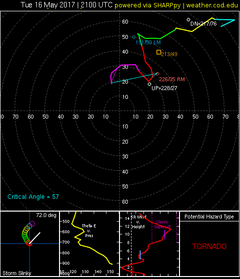
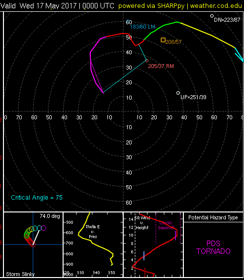
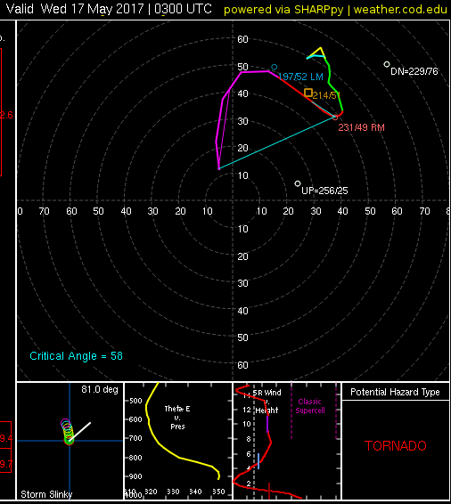
I have not included the soundings below, because several of the points I plotted were in the updrafts of that storm. However, you can see the hodograph evolution northwest of Gage OK for these three model hodographs, 21 UTC, 00 UTC, and 03 UTC. If the middle hodograph develops in this manner, there will be a three hour period or so when a storm in that environment will be taking advantage of that enormous shear and long hodograph loop implications.
The final hodograph, though, indicates that the storm motion will be near the hodograph, so evolution into an HP-supercell would be likely. Along the way, any large tornado would likely be wrapped in rain the last few hours of this cycle. Earlier on, this looks like a classic supercell tornado setup, though.