
It’s hard to ignore the strong signals arguing for some high end severe storms tomorrow in the southern Great Plains. The only issue appears to be whether initiation will occur.
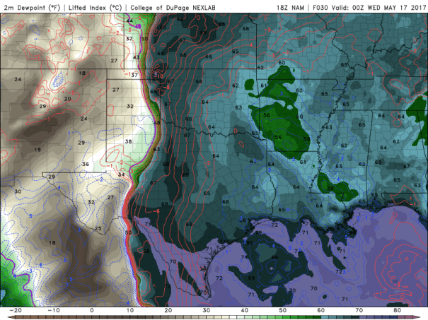
The latest run of the NAM has a marked dryline bulge into northwestern Oklahoma Tuesday afternoon, with strong low-level convergence along it.

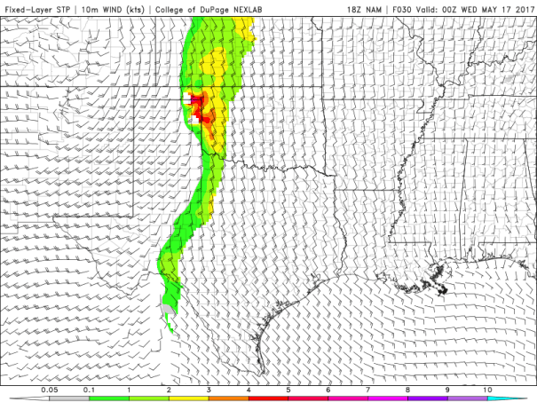
You can see the convergence showing up in the wind field from just north of Abilene to the eastern TX Panhandle Tuesday evening around 7PM in the forecast view. It also shows up in a dryline bulge and marked dew point gradient in the same area.
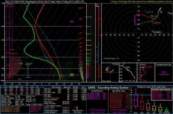
Overspreading that area Tuesday afternoon will be southwesterly winds >50 knots providing strong 0-6 km shear. This in combination with the other ingredients, including mlCAPE values >4000 J/kg has the Significant Tornado Parmeter

Should be an interesting and potentially dangerous day for storm observers in western Oklahoma.
